About Burlington
Burlington (Canada 2011 Census population 175,779), is a city located in Halton Region at the western end of Lake Ontario. Burlington is part of the Greater Toronto Area, and is also included in the Hamilton Census Metropolitan Area. Physically, Burlington lies between the north shore of Lake Ontario and the Niagara Escarpment. Economically, Burlington is strategically located near the geographic centre of the Golden Horseshoe, a densely populated and industrialized region home to over 8 million people.
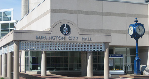
Some of the city’s attractions include Canada’s Largest Ribfest, Sound of Music Festival, Burlington Art Centre, and Spencer Smith Park, all located near the city’s municipal offices in the downtown core. Additionally, the city attracts hikers, birders and nature lovers due to the Royal Botanical Gardens located on the border with Hamilton, as well as its proximity to a part of the Niagara Escarpment in the north end of the city that includes the Iroquoian section of the Bruce Trail.
Background Information
Before pioneer settlement in the 19th century, the area was covered by the primeval forest that stretched between the provincial capital of York and the town of Hamilton, and was home to various First Nations peoples. In 1792, John Graves Simcoe, the first lieutenant governor of Upper Canada, named the western end of Lake Ontario “Burlington Bay” after the town of Bridlington in the East Riding of Yorkshire, England. By the time land beside the bay was deeded to Captain Joseph Brant at the turn of the nineteenth century, the name “Burlington” was already in common use. With the completion of the local survey after the War of 1812, the land was opened for settlement. Early farmers prospered in the Burlington area because of the fertile soil and moderate temperatures. Produce from the farms was shipped out via the bustling docks of the lakeside villages of Port Nelson and Wellington Square, as well as Brown’s Wharf in the nearby village of Port Flamborough (which was to become Aldershot). Lumber taken from the surrounding forests also competed for space on the busy docks. However, in the latter half of the 19th century, increased wheat production from Western Canada convinced local farmers to switch to fruit and vegetable production.
In 1874, Wellington Square and Port Nelson were incorporated into the Village of Burlington. However, the arrival of large steamships on the Great Lakes made the small docks of the local ports obsolete, and the increased use of railway to ship goods marked the end of the commercial wharves.
Farming still thrived though, and the resultant growth resulted in continued prosperity. By 1906, the town boasted both its own newspaper—the Burlington Gazette—as well as a town library and a local rail line that connected Burlington to nearby Hamilton. During the First World War, 300 local men volunteered for duty in the Canadian Expeditionary Force – 38 did not return. In 1915, Burlington was incorporated into a town.
As more settlers arrived and cleared the land, cash crops replaced subsistence farming. Gradually, mixed farming and market gardens became the dominant form of agriulture, and in the early twentieth century the area was declared the Garden of Canada. The first peaches grown in Canada were cultivated in the Grindstone Creek watershed, which is located in the south-west part of the city. The farming tradition has passed down through the generations. Today over forty percent of the Grindstone Creek watershed is still devoted to farms, orchards and nurseries.
Following the Second World War, cheap electricity from nearby Niagara Falls and better transportation access due to the new (1939) Queen Elizabeth Way encouraged both light industry and families to move to Burlington. The population skyrocketed as new homes were built, encouraging developers to build even more new homes. On January 1, 1958, Burlington officially annexed most of the Township of Nelson, as well as Aldershot, formerly a part of East Flamborough Township. By 1967, the last cash crop farm within the city had been replaced by the Burlington Mall.
By 1974, with a population exceeding 100,000, Burlington was incorporated as a city. The extremely high rate of growth continued, and between 2001 and 2006, the population of Burlington grew by 9%, compared to Canada’s overall growth rate of 5.4%. By 2006, the population topped 160,000. Continued high rates of growth are forecast as farmland north of Dundas Street (former Highway 5) and south of Highway 407 is developed into more suburban housing.
Burlington Demographics
According to the 2011 census, Burlington’s population was 175,779. As of the 2006 census, 48% of residents were male and 52% female. Minors (individuals under the age of 18) made up 24.5% of the population (almost identical to the national average of 24.4%), and pensioners (age 65+) numbered 15.4% (significantly higher than the national average 13.7%). This older population was also reflected in Burlington’s average age of 40.3, which was higher than the Canadian average of 39.5.
As recorded in the same census, 91.04% of the population was white. Other groups include South Asian: 3.1%, mixed race: 1.5%, black: 1.5%, and Chinese: 1.3%.
According to the 2011 Census, English is the mother tongue for 80.7% of the residents of Burlington, followed by French (1.8%), Polish (1.3%), Spanish (1.2%), German (1.1%) and Italian (1.1%). However, Statistics Canada warned that “data users are advised to exercise caution when evaluating trends related to mother tongue and home language that compare 2011 census data to those of previous censuses,” due to the discontinuation of the mandatory long census form by the federal government.
In the 2001 Canadian census, 78% of Burlington residents identified themselves as Christian. Of these, approximately 41% claimed adherence to one of the mainstream Protestant churches or were Anglican, 32% were Roman Catholic, and the remaining 27% belonged to other denominations such as the Church of Jesus Christ of Latter Day Saints (Mormons), the Ukrainian Catholic Church, and various Orthodox denominations. Of the remaining 22% of the population that did not identify themselves as Christian, 16.6% identified themselves as following no religion, 1.0% were Muslim, 0.7% Sikh, 0.5% Hindu, 0.4% Jewish, 0.3% Buddhist, and 0.1% Pagan.
The Economy in Burlington
Burlington’s economic strength is the diversity of its economic base, mainly achieved because of its geography, proximity to large industries in southern Ontario (Canada’s largest consumer market), its location within the Greater Toronto and Hamilton Area (GTHA) and proximity to Hamilton, and its transportation infrastructure. This diversity has allowed for sustained growth with regards to the economy. The city has a robust economy with potential for future growth – it is located at the hub of the Golden Horseshoe, is largely driven by both the automotive and manufacturing sectors. The city has historically been a destination with a high quality of life, being most recently named the 2nd best city in Canada in which to live.
No single employer or job sector dominates Burlington’s economy. The leading industrial sectors, in terms of employment, are food processing, packaging, electronics, motor vehicle/transportation, business services, chemical/pharmaceutical and environmental. The top five private sector employers in Burlington are Fearmans Pork Inc, Cogeco Cable, Evertz Microsystems, Boehringer Ingelheim and EMC2. The largest public sector employers in the city are the City of Burlington, the Halton District School Board, the Halton Catholic District School Board and Joseph Brant Memorial Hospital.
The Burlington Mall and Mapleview Centre are popular malls within the city. The many summer festivals in the city, include Canada’s Largest Ribfest, and the Burlington Sound of Music Festival which also attract many visitors.
All information about Burlington courtesy of Wikipedia.